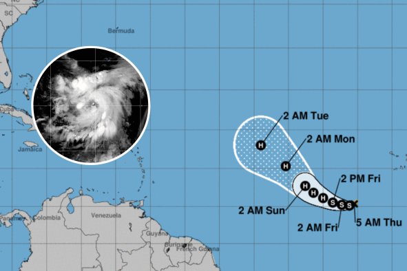
As recovery efforts continue following the devastating impact of Hurricane Helene, Florida is now in the sights of a potential new tropical storm or hurricane.
Helene was the strongest hurricane on record to make landfall in Florida's Big Bend region, the Weather Channel reported, and caused damage in an area spanning 400 miles, according to ABC News.
Meteorologists from AccuWeather are urging residents, businesses and emergency officials in the Sunshine State to prepare for the possibility of heavy rainfall, strong winds, flooding and possible storm surges next week.
"We are forecasting an area of low pressure to organize this weekend over southern Mexico and the Bay of Campeche, and then we expect tropical development in the southern Gulf of Mexico early next week," AccuWeather chief on-air meteorologist Bernie Rayno said in a media advisory on Wednesday.
"We expect this potential tropical threat to start moving toward Florida by next Tuesday or Wednesday."
Several atmospheric conditions will play a pivotal role in determining whether this tropical disturbance develops into a more serious threat.
One of the most crucial factors is wind shear. Wind shear refers to the variation in wind speed and direction at different altitudes, and it can have a profound impact on tropical storms and hurricanes.
"If the wind shear remains stronger, this system will likely remain disorganized and it is unlikely to develop into a hurricane," Rayno said. In such a scenario, Florida would primarily face heavy rain and localized flooding.
However, if the wind shear decreases, the system could strengthen into a tropical storm or even a hurricane, bringing more severe impacts, such as damaging winds, storm surges and widespread flooding.
"At this time, the intensity will range from a sprawling tropical rainstorm to perhaps a strike from a more compact, full-blown hurricane," Rayno said.
Another critical element influencing the development of this potential storm is the unusually warm water temperatures in the Gulf of Mexico. Despite Hurricane Helene's recent passage, AccuWeather Lead Hurricane Expert Alex DaSilva said that the Gulf's water temperatures remain exceptionally high.
"Water temperatures continue to remain warm in the wake of Helene over the southeastern Gulf of Mexico," DaSilva said. "Not only is the surface water warm, but it remains warm down deep so that wave action from any storm has little cooling effect."
Warm water acts as fuel for tropical storms, providing the energy needed for them to intensify. This raises concerns that, if the wind shear diminishes, the system could rapidly strengthen as it approaches Florida.
While it is still unclear whether this system will develop into a named storm or even a hurricane, experts agree that the Florida Peninsula should brace for significant rainfall and gusty winds early next week.
"A broad area of low pressure is likely to develop over the Gulf of Mexico late this weekend or early next week, but subsequent tropical or subtropical development could be limited by the system's potential interaction with a frontal boundary," the National Weather Service said in its Tropical Weather Outlook.
"Regardless of development, locally heavy rains could occur over portions of Mexico during the next few days and over portions of the Florida Peninsula next week."
The timing and intensity of the impacts will depend heavily on how the system interacts with the wind shear and the Gulf's warm waters in the coming days.
"We are not expecting any sort of repeat from Helene in the southern Appalachians with this next tropical threat," said AccuWeather flood expert Alex Sosnowski in the media advisory. "However, Florida needs to be on alert for more heavy rainfall and river flooding next week."
Thankfully, conditions are forecast to remain dry in the areas hardest hit by Helene prior to the new system's arrival. This should help with cleanup efforts from the storm, which caused over $100 billion in damage and economic losses.
Do you have a tip on a science story that Newsweek should be covering? Do you have a question about hurricanes? Let us know via science@newsweek.com.
Disclaimer: The copyright of this article belongs to the original author. Reposting this article is solely for the purpose of information dissemination and does not constitute any investment advice. If there is any infringement, please contact us immediately. We will make corrections or deletions as necessary. Thank you.


